| Type | CONTROL5 | PAVALA10 | Diff (pav10 - ctrl5) |
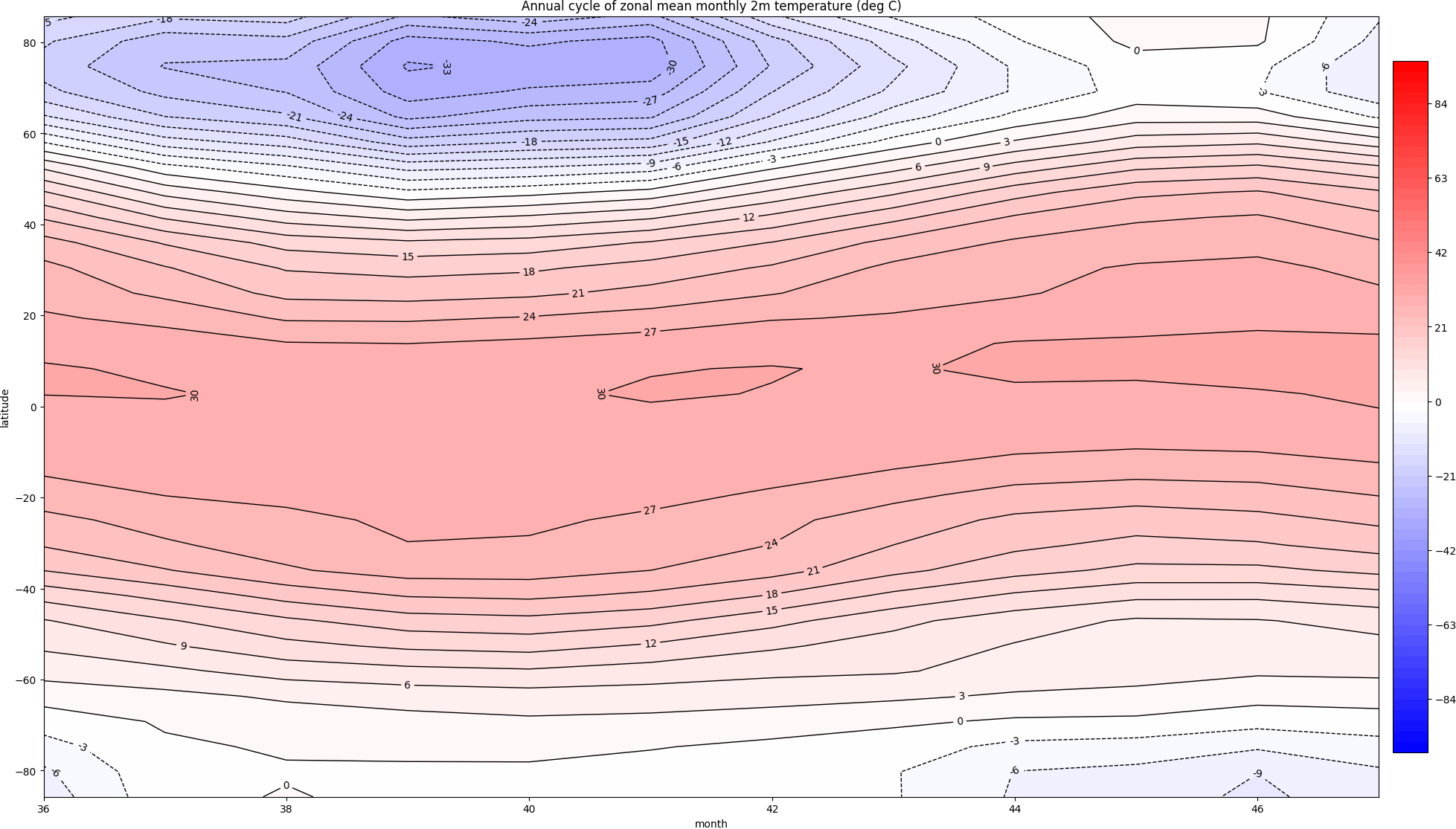
| temperature | 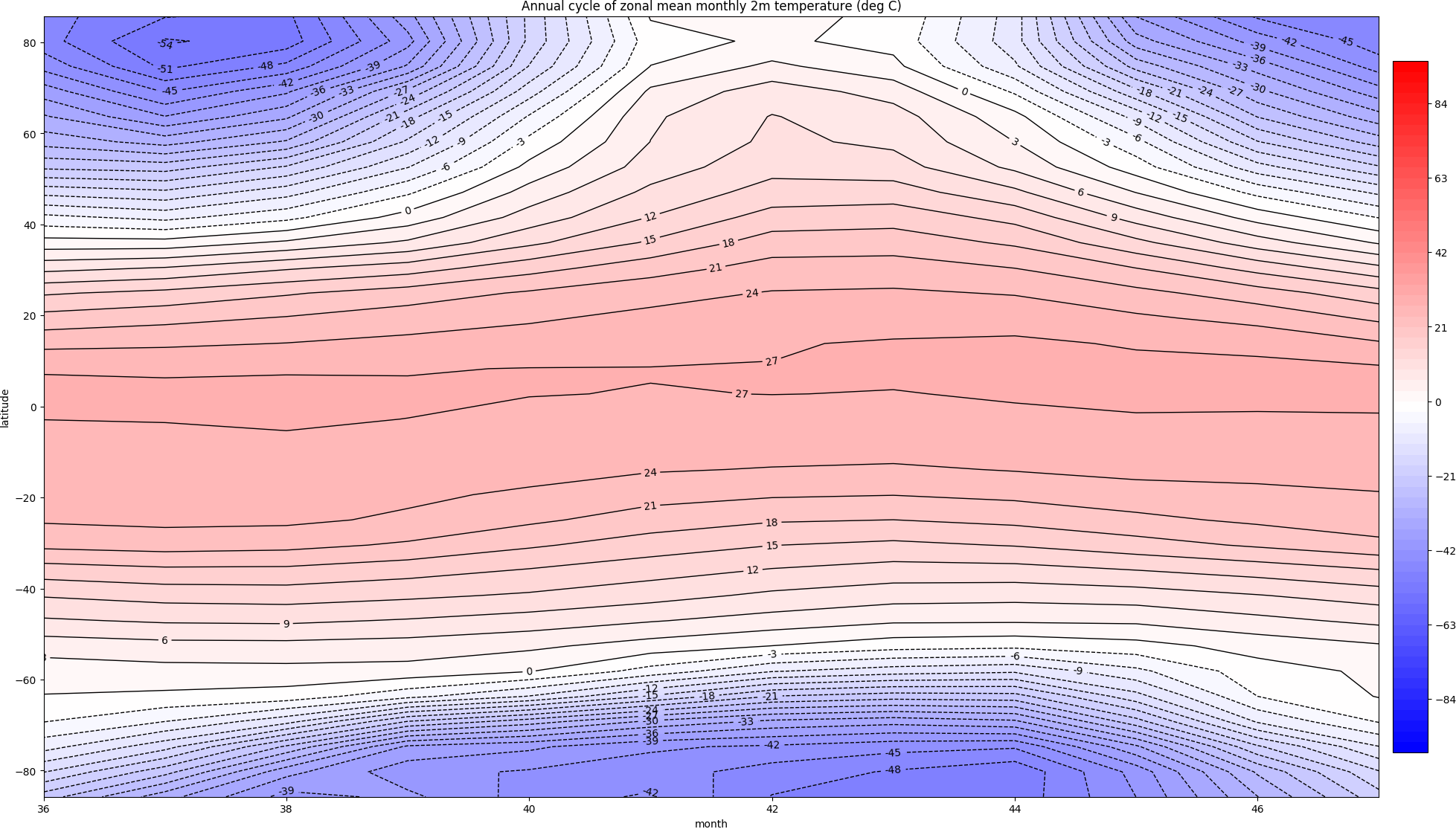 |
 |
 |
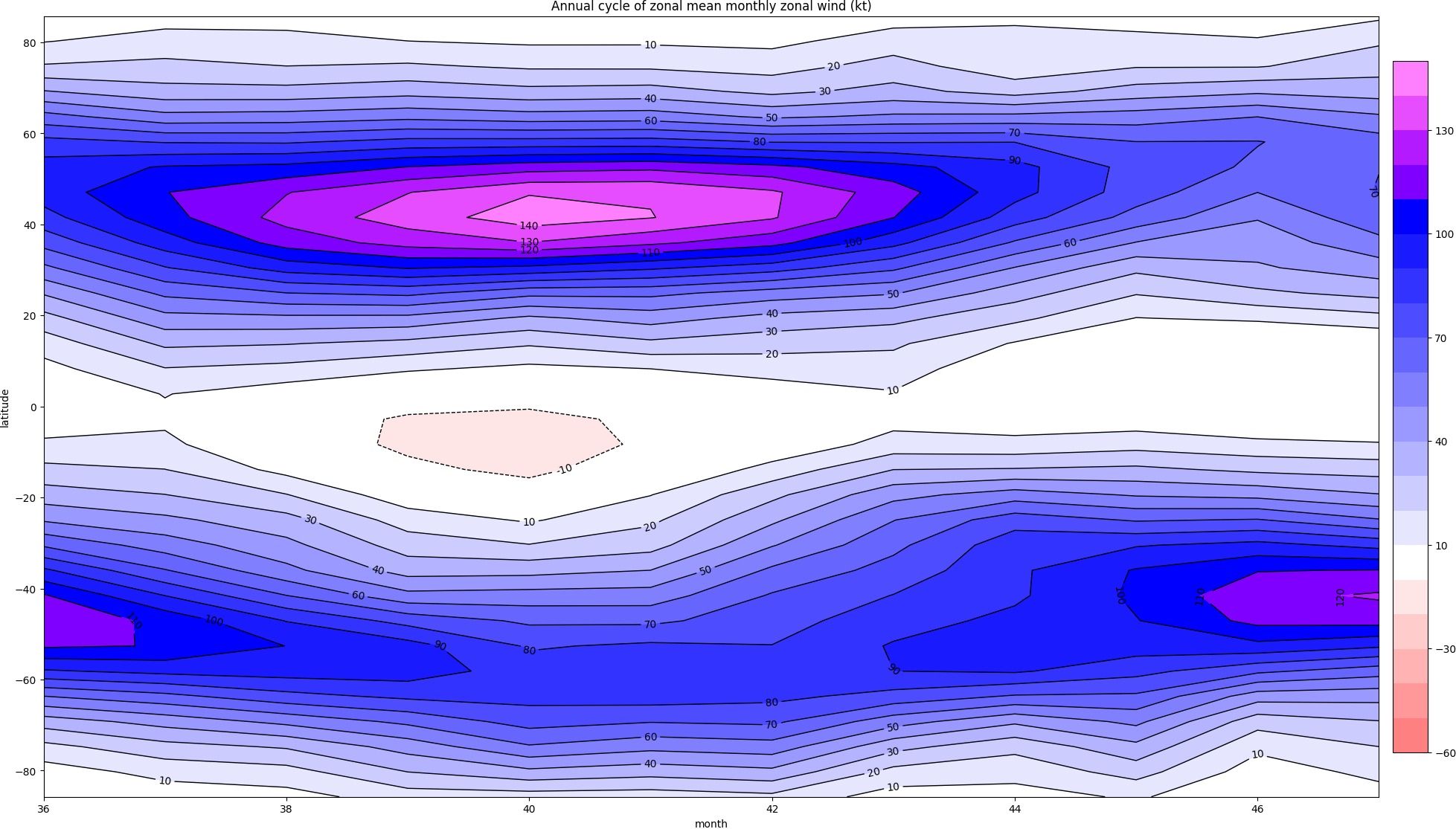
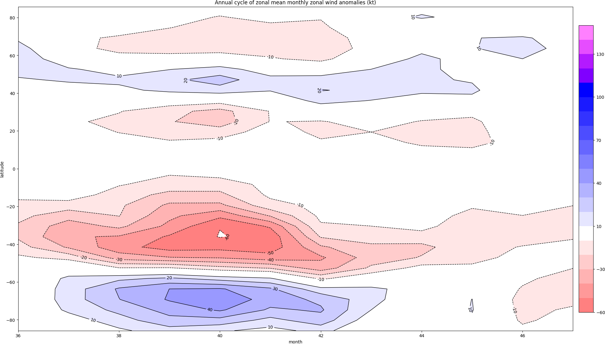
| zonal wind | 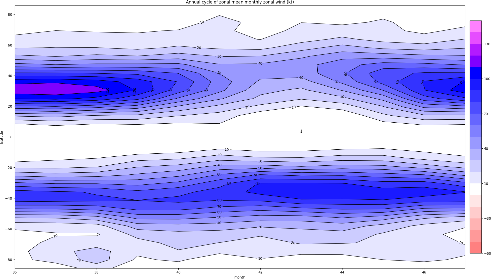 |
 |
 |
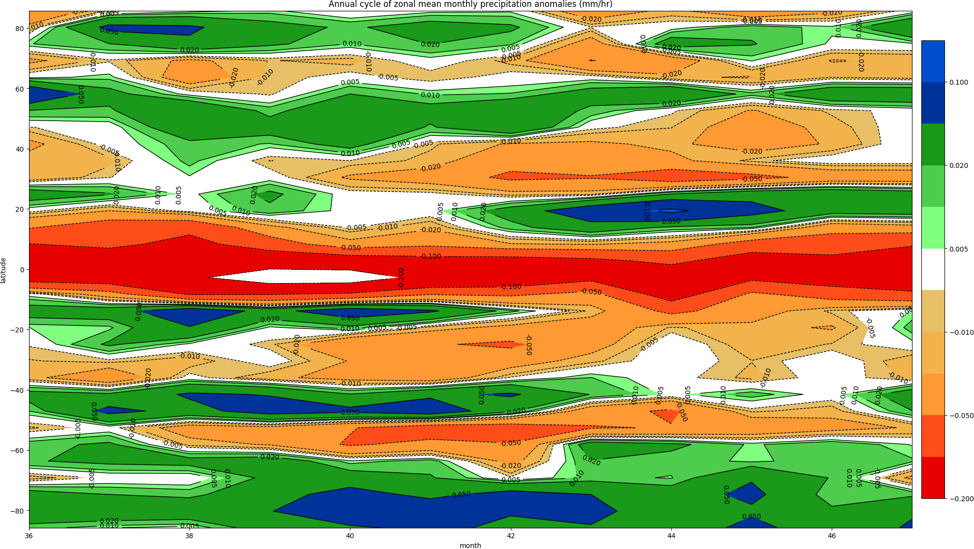
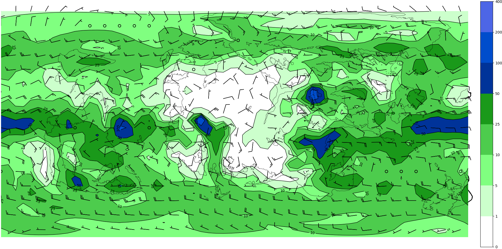
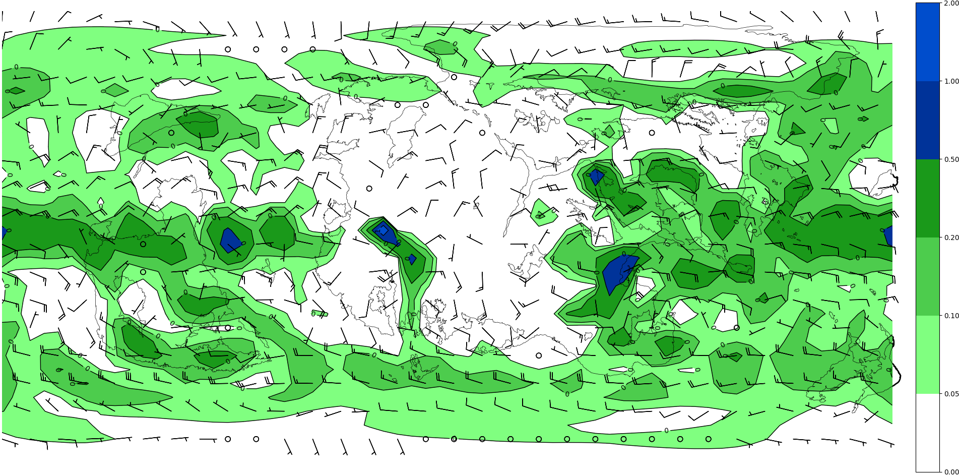
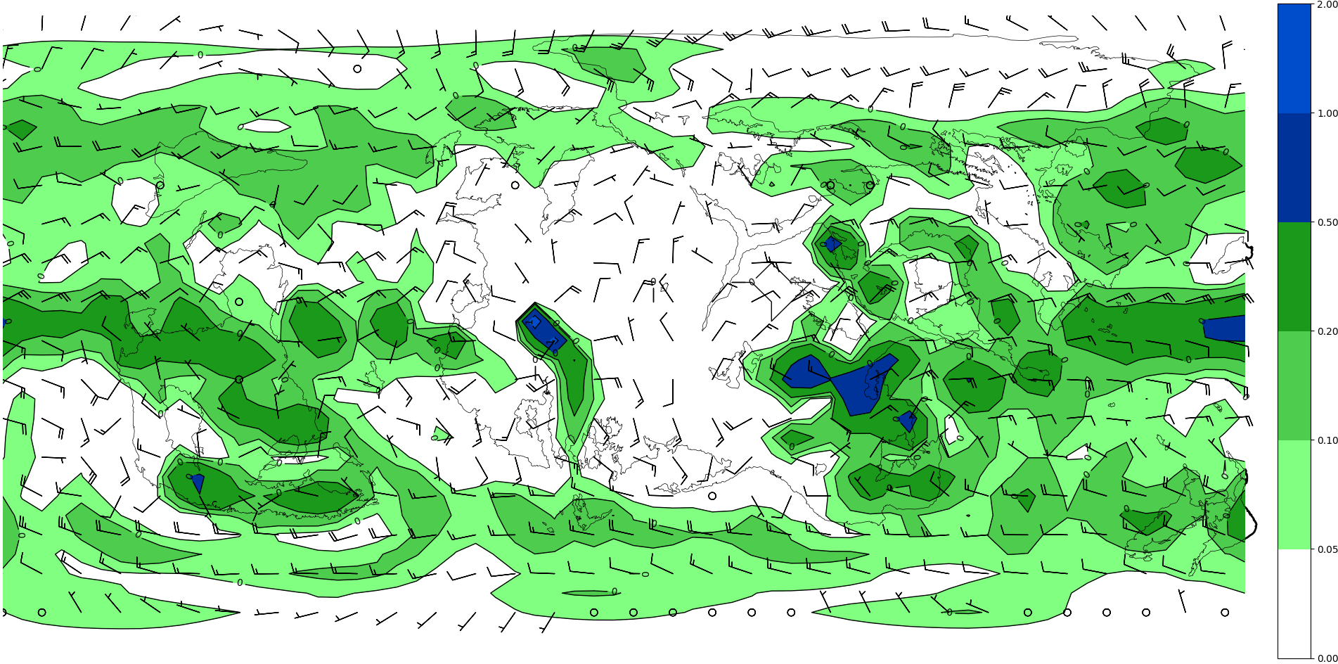
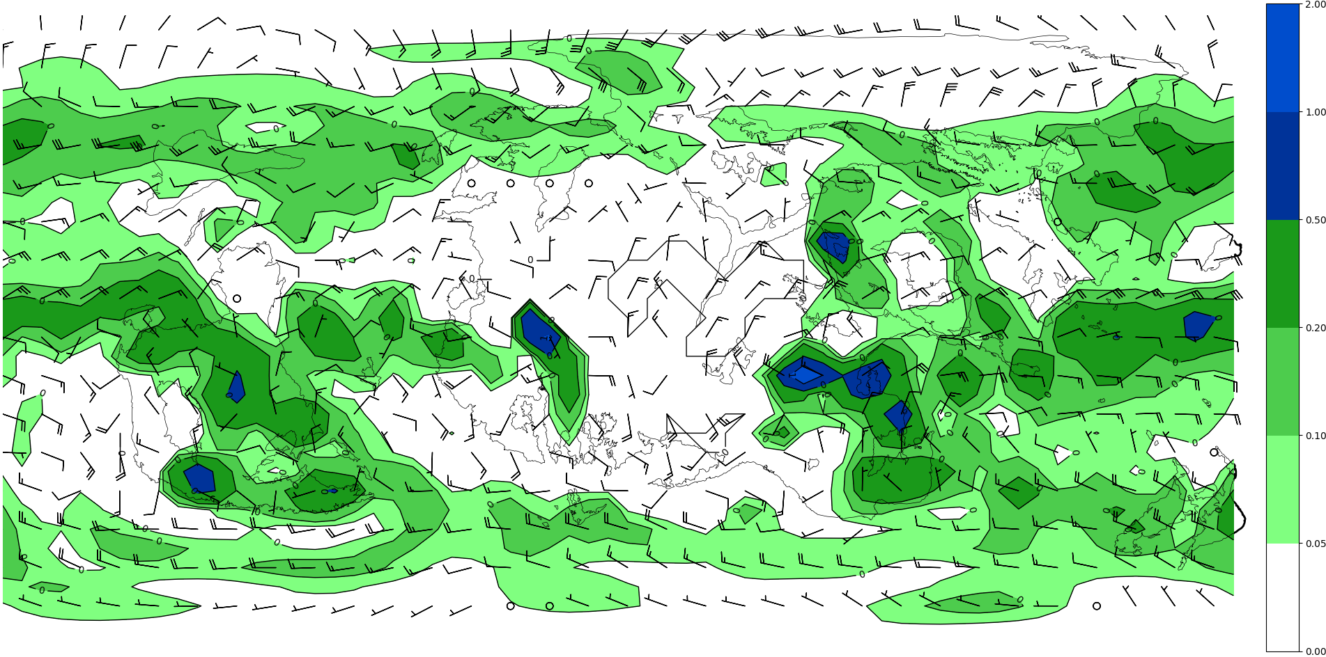
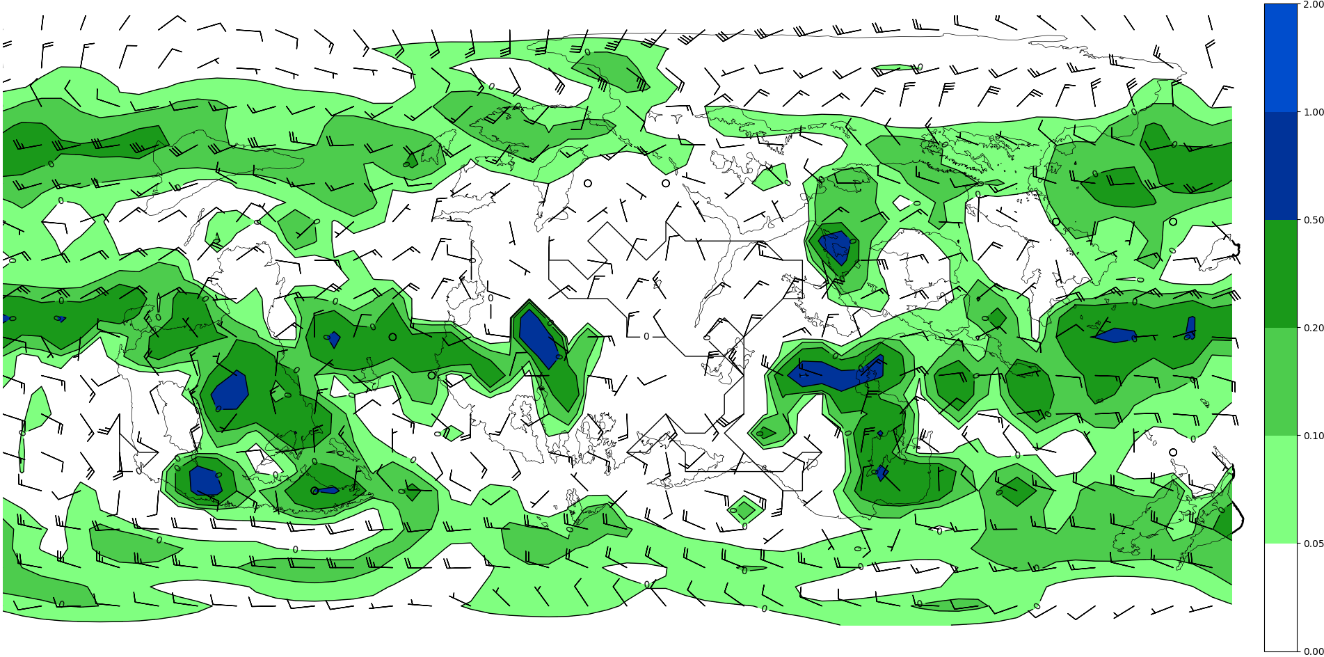
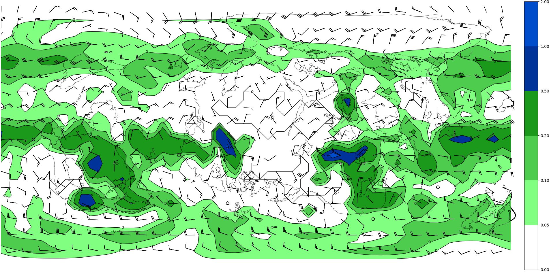
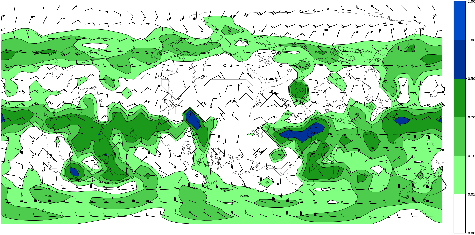
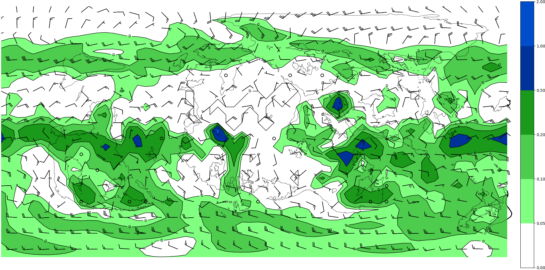
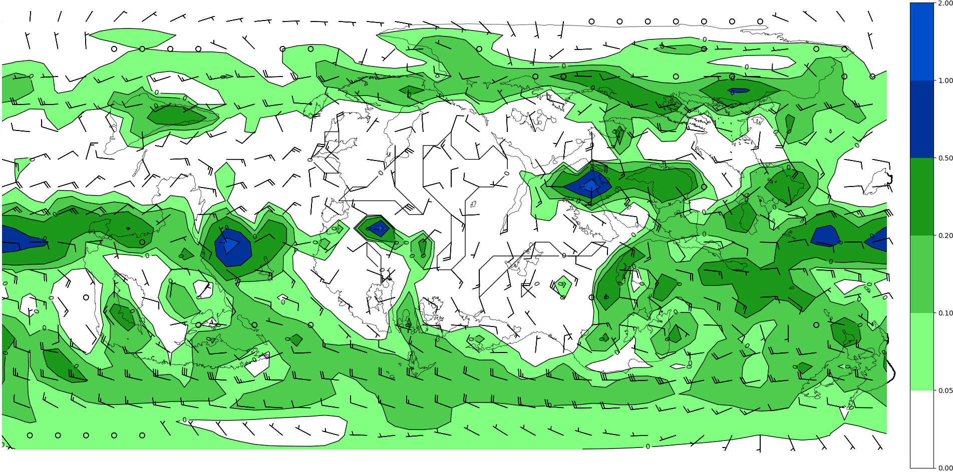
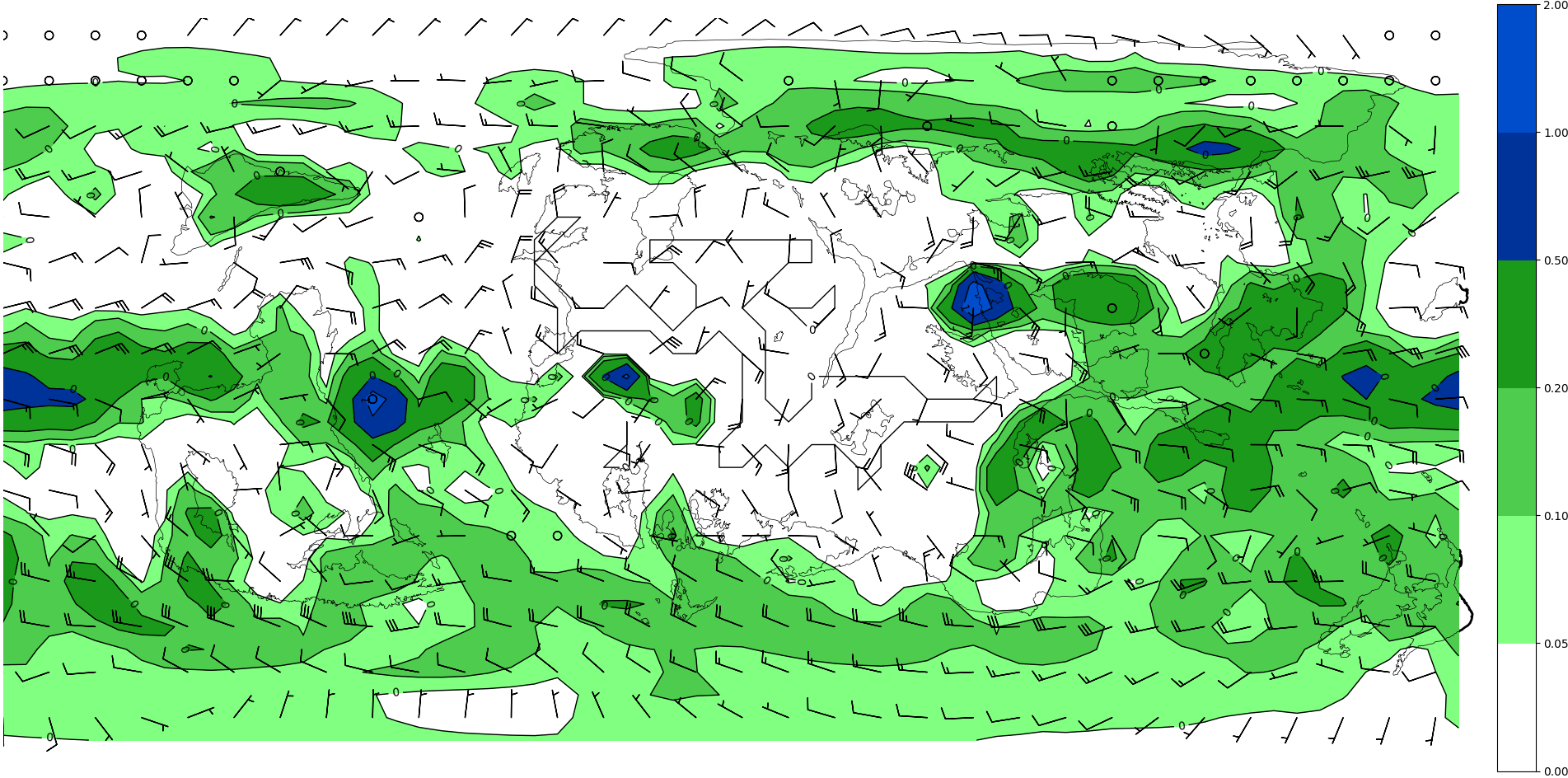
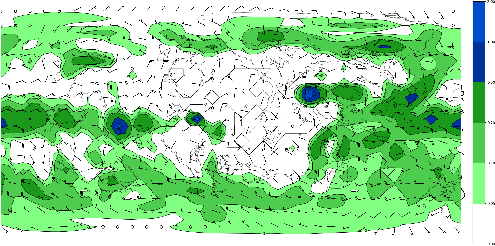
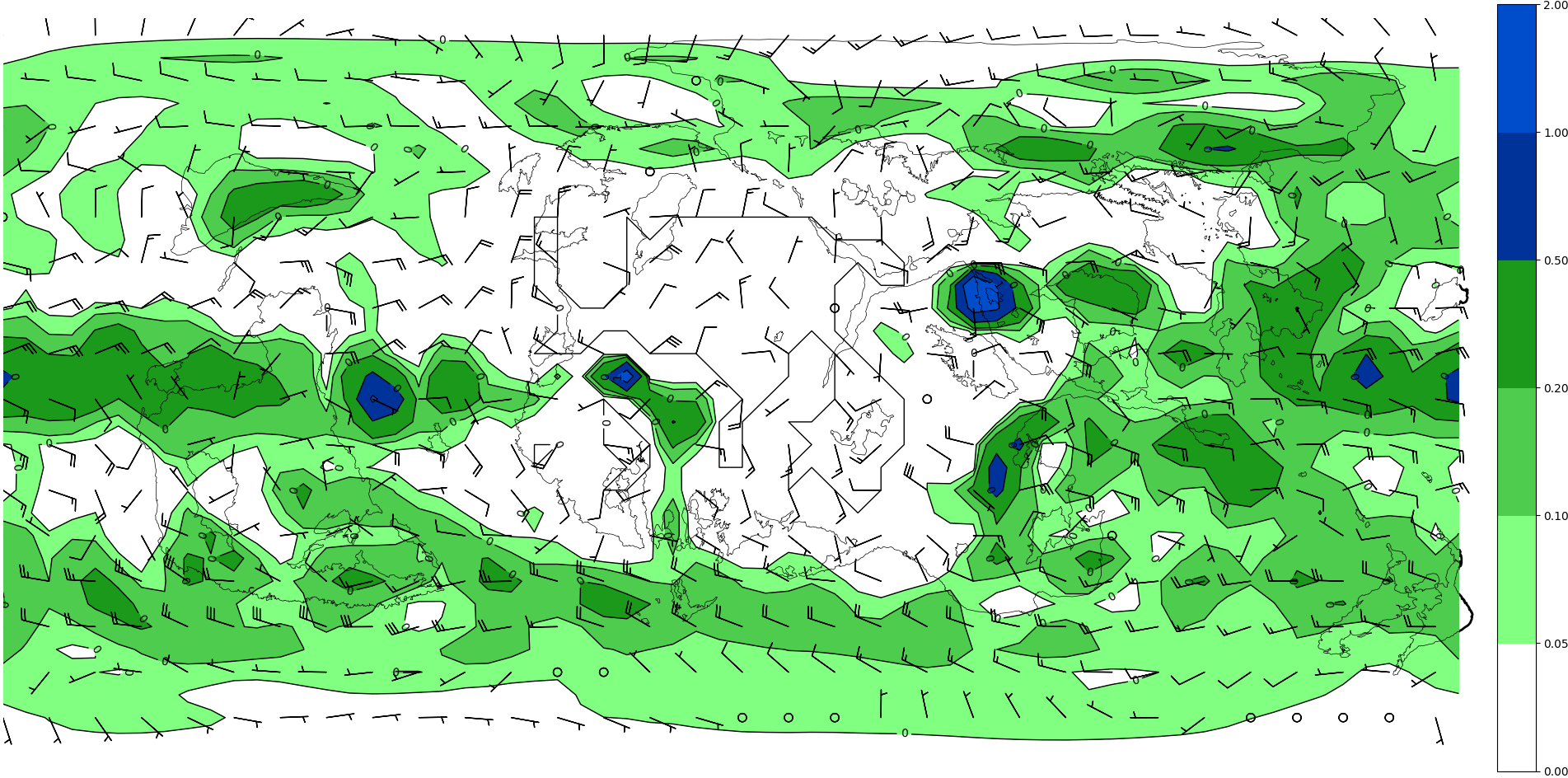
| precipitation | 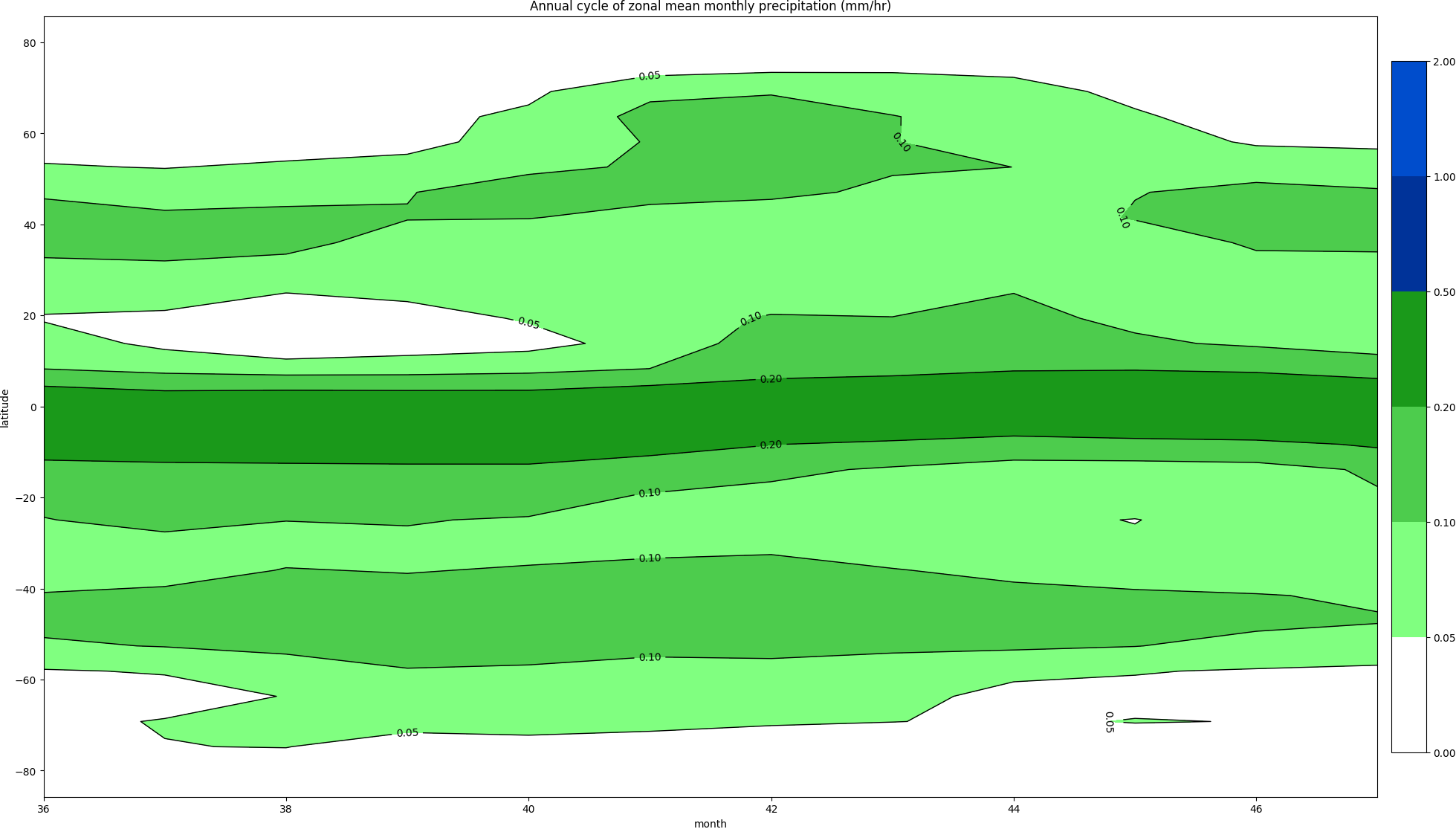 |
 |
 |
| sea ice thickness | 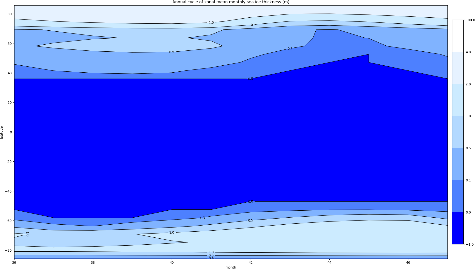 |
 |
 |
| Type | CONTROL5 | PAVALA10 | SGPCONTROL |
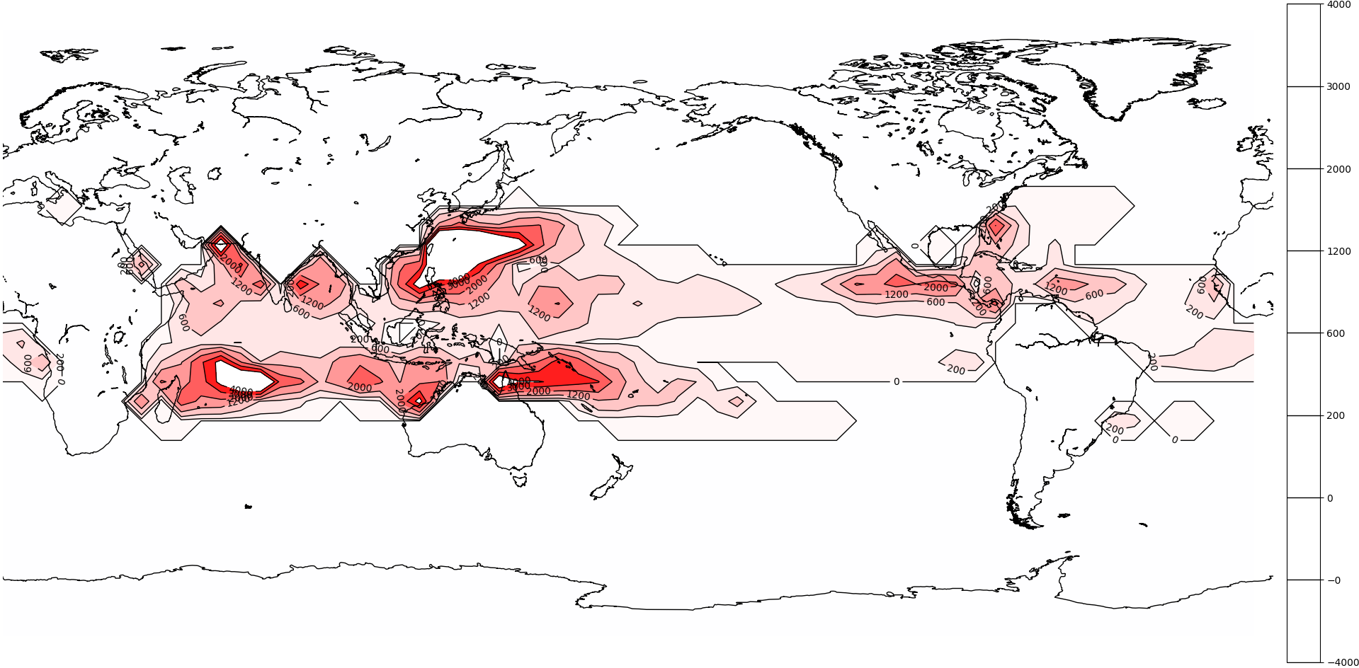
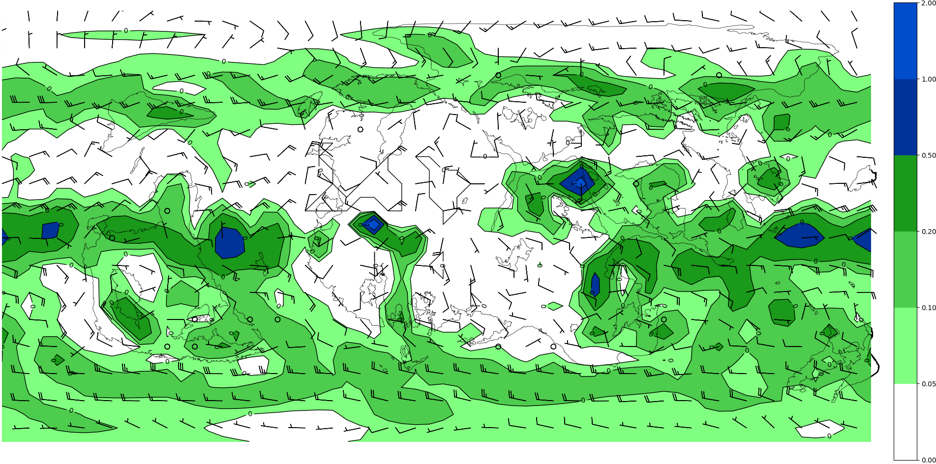
| Precipitation (annual mean) | 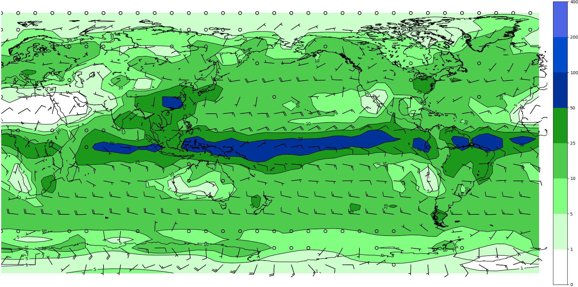 |
 |
 |
| (monthly) | - | J F M A M J J A S O N D | - |
| Seasonal genesis parameter1 (annual max) | 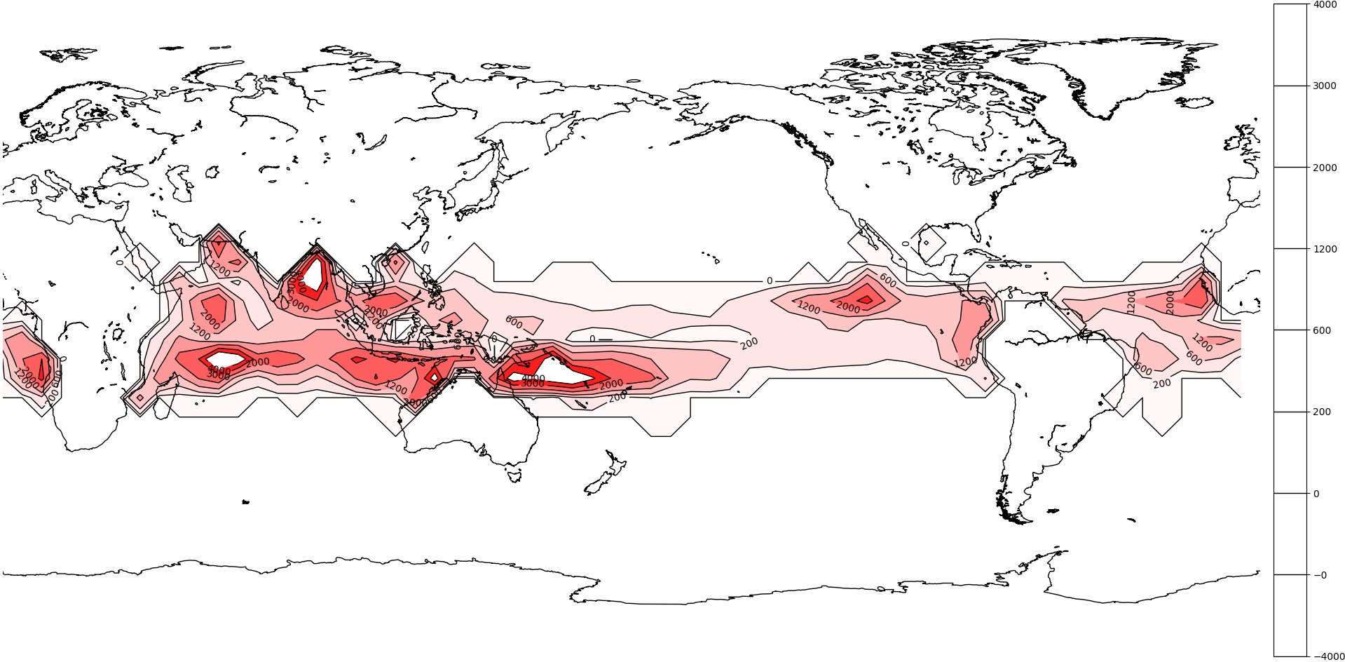 |
 |
 |
| Property | Last update |
| Land data | unknown (before March 2020) |
| Coastline | unknown |